
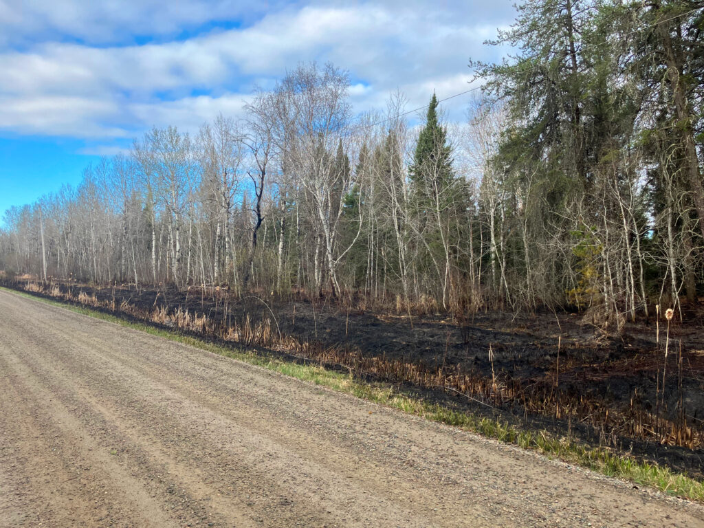
Residents of Canada’s north are no strangers to the threat of wildfires breaking out near their communities and the danger that they represent to life and property. But those who have never met a blaze face-to-face might be less familiar with the steps taken to control fires in the bush.
There’s much more that goes into controlling wildfires than just sending firefighters out with a hose, said Chris Marchand, a fire information officer with Aviation, Forest Fire and Emergency Services (AFFES), a branch of the Ministry of Natural Resources (MNR).
In 2023, Canada saw 6,837 forest fires that torched 17,606,547 hectares, the metric unit used to measure the area of a fire, equal to 10,000 square metres. Seven hundred and sixty of those fires occurred in Ontario, with 441,610 hectares burned. In 2024, there were significantly fewer wildfires in Canada, with 5,844 nationwide and 5,374,344 hectares.
So far this year, there have been no major wildfires reported in the Rainy River District, but that can change quickly. The federal government’s 2026 wildfire season preparedness and outlook warns that “forward-looking forecasts indicate above-normal temperatures for nearly all Canadian regions for June, July and August,” with signals for below normal precipitation over northwestern Ontario.
“Natural Resources Canada’s modelling currently shows fire danger building through July across Canada with British Columbia facing the highest and most sustained fire risk,” according to Public Safety Canada. “Over the same period, elevated fire danger could also emerge quickly in parts of northern, central and eastern Canada.”
That forecast, which is always subject to change, is built on data about moisture recovery, limited large-scale predictability of heat and dry conditions, topography and fuels and fire spread rates.
When a fire does break out, it’s assessed and receives “an appropriate response based on the circumstances and the conditions of the fire,” Marchand told The Times. “Wildland fires that pose an immediate threat to human lives, property and infrastructure are responded to as quickly as possible to minimize damage and disruption. On the other side of things, if wildland fires are not threatening communities, they can be managed effectively to limit negative impacts and enable the ecological role of fire, as well to manage costs.”
According to Marchand, there are two main causes for wildfires: lightning and human activity.
“In Ontario, lightning and human-caused fires each account for about 50 per cent of wildland fire causes; about half and half between the two of them,” he said.
“Human-caused fires encompass any scenario where human activity on the landscape contributes in any way to the source of ignition. That could mean trees falling on power lines, rail, forestry or mining activity, recreational vehicles and in travel corridors like highways.”
Human-caused fires generally happen in proximity to municipalities but can also be the result of a spark from infrastructure in rural, unmonitored areas. Lightning-caused fires can occur anywhere, with little predictability outside of watching where a storm is moving through.
Rate of spread
When a fire is detected, regardless of lightning or human activity being the cause, it is continuously monitored to detect how quickly the flames will spread.
“There’s a formula that takes into consideration weather values and fuel moisture,” Marchand said. “A rate of spread is calculated using a combination of weather observations and forecasts. That information is combined with forest fuel type and the Canadian Forest Fire Danger Rating System to estimate how quickly a fire may spread.”
Forest fuels are any burnable materials involved in a wildfire, such as grass, trees, pine needles and other brush. The Canadian Forest Fire Danger Rating System looks at terrain, humidity levels, wind and other natural aspects that can impact the ability to spread.
Combining these factors gives the MNR an educated estimate of the spread rate based on past similar situations.
“The fire’s behaviour is then continuously observed and assessed by a qualified incident commander on scene to validate and adjust those predictions based on current conditions,” Marchand said.
Controlling the flames
When it comes to controlling a fire that poses a threat to life, the go-to method is to send firefighters to push back flames with pumps and hoses, but sometimes things get a bit too heated for that.
“In some cases, fire behaviour can be too extreme to put personnel within close proximity,” Marchand said. “In cases such as that, where you need to get crews started, water bombers can be very helpful in just reducing that extreme fire behaviour and letting crews get in there and get their pumps and hoses established.”
“It’s a common misconception that water bombers put fires out. It’s actually the crews on the ground who are putting the fires out. The water bombers are there to reduce that fire intensity to allow those crews to get established in those areas.”
Personnel on the ground also rely on helicopters equipped with a belly tank—a compartment holding large quantities of water—to target and dump on specific hotspots where the flames burn too heavily to be controlled by hose.
Once the ground crews have established themselves close enough to the fire itself, they begin to circle the area with their hoses and work inward. This method evenly reduces the flames on each side, not allowing the spread to break out in a direction that isn’t getting attention.
Another frequent technique in controlling wildfires is the creation of corridors in the woods where forest fire fuels are cleared.
“Heavy equipment is used to build fire breaks,” Marchand said. “They push a corridor through the forts where combustible organic material is removed right down to the mineral soil, and that creates a break in an attempt to contain spread. A creeping fire will not be able to spread into just mineral soil.”
Preventing wildfires
Everyone is responsible for doing their part to avoid starting fires. An important first step in preventing fires is to be informed of local conditions.
Marchand advises starting by familiarizing oneself with the interactive fire map on the Government of Ontario website.
This map shows forest fire danger ratings from low to extreme, active fires, their proximity and whether or not they are under control. The map is viewable at https://bit.ly/4e880Ks.
The MNR also advises avoiding burning anything in high winds. If campfires need to be started in dry and windy conditions, always keep them small and with some sort of wind cover. Never leave any fires unattended and ensure the charcoal has been fully extinguished before leaving the area.
When burning campfires in high fire risk conditions, keep water and hand tools like shovels nearby to control if necessary.
To ensure vehicles are not the cause of a fire, Marchand said to keep an eye on tire pressure and trailer chains to avoid sparks from rims or contact between the chain and road.
If using recreational trail vehicles like ATVs, side-by-sides or dirt bikes, keep the exhaust clear from brush as the heat can quickly ignite dry materials.
Anyone in northern Ontario who notices smoke of a suspected wildfire, or who has inadvertently started one themselves, can reach out to the wildland fire reporting hotline by dialling 310-FIRE (3473), or 1-888-284-3473 if they have a cell phone plan from outside of Ontario.
Anyone south of the French and Mattawa rivers can report a fire by simply dialling 911.


